
Use the information on this page to help you understand and prepare for flooding if you live near Carruthers Creek in the Town of Ajax..
1. KNOW YOUR RISKS
The Lower Carruthers flood vulnerable cluster (FVC) is located within the Carruthers Creek watershed, between Pickering Beach Road and Shoal Point Road and south of Bayly Street, in the Town of Ajax.
The main branch of the Lower Carruthers Creek drains through Pickering Beach neighborhood to the Carruthers Creek wetland, then out to Lake Ontario. The creek meanders considerably through this stretch. The land use along the creek is mainly low density residential.
DEFINITIONS
Flood vulnerable cluster: An area within the flood plain that has a high concentration of buildings and roads that could be impacted by riverine flooding.
Do You Live in an Area at Risk of Riverine Flooding?
USE OUR MAP VIEWER TO FIND OUT.
If you’re not sure whether your home is in a floodplain, use Toronto and Region Conservation Authority’s (TRCA) Flood Plain Map Viewer to find out. Just enter your address in the search bar.
If your home lies within the blue shaded areas (as shown below), you are within the flood plain and could be at risk of flooding.

Understanding Flood Risk in the
Lower Carruthers Community
The Pickering Beach area was originally developed in the 1920s as a summer resort and vacation destination for families from Toronto, and was made up of mostly cottage dwellings. Over the years, the Lower Carruthers flood vulnerable cluster in the Pickering Beach community has been significantly developed with larger residences.
A spill exists in the area upstream of Shoal Point Road, where during a Regional Storm sized event flood waters will flow through rear properties along Seabreeze Road, and continue south along Ruthel Road, through Paradise Park before out letting to Lake Ontario just south of Lakeview Boulevard.
Shoreline flooding is also a risk in this cluster when high water levels in Lake Ontario, combined with wind and wave action, may sometimes block the outlet of the Carruthers Creek wetland. This results in water (drainage) backing up in the ditches and low‐lying roads near and in Paradise Park and Paradise Beach.

What Types of Flooding Can Affect Lower Carruthers Residents?
Did you know that there are several types of flooding? Different levels of government are responsible for different types of flooding. To find out who to contact during a flood, see BE PREPARED.
- Riverine flooding occurs when the water levels of rivers rise, overflowing their banks. Reducing riverine flood risk is under the mandate of Conservation Authorities like TRCA.
- Shoreline flooding occurs when critical high-water levels and waves result in shoreline flooding and/or erosion. Shoreline flooding is monitored by Conservation Authorities, while Great Lakes flows and water levels are regulated by international bodies such as the International Joint Commission (IJC).
- Urban or Pluvial flooding consists of street flooding, basement flooding, and flooding of other low-lying areas due to the overflow of local drainage systems. Municipalities are responsible for managing this type of flooding.
Flooding in Ajax Can Happen at Any Time of Year
| WINTER: A rise in the water level or a thaw can break winter ice into large chunks, which can lead to jams behind culverts and crossings. | |
| SPRING: Rivers and streams can experience high flows in the early spring, as rising temperatures melt the winter’s accumulation of snow, causing water levels to rise. | |
| SUMMER: Intense, localized downpours from thunderstorms can quickly lead to flooding in smaller creeks. With a highly urbanized drainage area, the Lower Carruthers cluster is particularly susceptible to flash flooding. | |
| FALL: Large wet weather systems, including tropical storms such as Hurricane remnants (like Hurricane Hazel in 1954), can last for several days. Prolonged and heavy precipitation, on top of already saturated soils, can cause rivers to rise. |
How Will I Know If Flooding
In Lower Carruthers Is Forecasted?
- TRCA operates a Flood Forecasting and Warning Program. If flooding is possible or about to occur, TRCA issues flood messages to designated individuals within municipalities, local agencies, school boards, the media, and members of the public who self-subscribe. LEARN MORE
- TRCA maintains a network of river and rainfall gauges. Get real-time gauging information.
- Lake Ontario Shoreline Conditions (Yellow)
- Lake Ontario Shoreline Flood Watch (Orange)
- Lake Ontario Shoreline Flood Warning (Red)
- Flood Ready – Tips for overland flooding and first steps to prepare your home
- 72 Hours: Is Your Family Prepared – Your Emergency Preparedness Guide
TRCA Issues the Following Types of Messages:
WATERSHED CONDITIONS STATEMENTS
Water Safety: High flows, unsafe banks, melting ice or other factors that could be dangerous for recreation. Flooding is not expected.

Flood Outlook: Early notice of the potential for flooding based on weather forecasts calling for conditions that could lead to high runoff, cause ice jams, lakeshore flooding or erosion.

FLOOD WATCH
Flooding is possible in specific watercourses or municipalities. Municipalities, emergency services, and individual landowners in flood-prone areas should prepare.

FLOOD WARNING
Flooding is imminent or already occurring in specific watercourses or municipalities.

LAKE ONTARIO SHORELINE FLOOD MESSAGES


Lake Ontario Shoreline messages are similar in category to riverine flood messages, but are only applicable to the Lake Ontario shoreline areas within TRCA’s jurisdiction (Toronto, Pickering, and Ajax).
They are issued when critical high water levels and waves are forecasted, imminent, or occurring on Lake Ontario, which could result in shoreline flooding and/or erosion.
2. BE PREPARED
When it comes to flood preparedness, everyone — homeowners, landlords, renters, and condo owners — has a role to play. You can take steps to prepare; just select a category below to find out more.
3. STAY INFORMED
Learn More About the Carruthers Creek Watershed
Within this cluster there are some areas that are designated by the Ontario Ministry of Northern Development, Mines, Natural Resources and Forestry as Provincial Areas of Natural and Scientific Interest (ANSI).
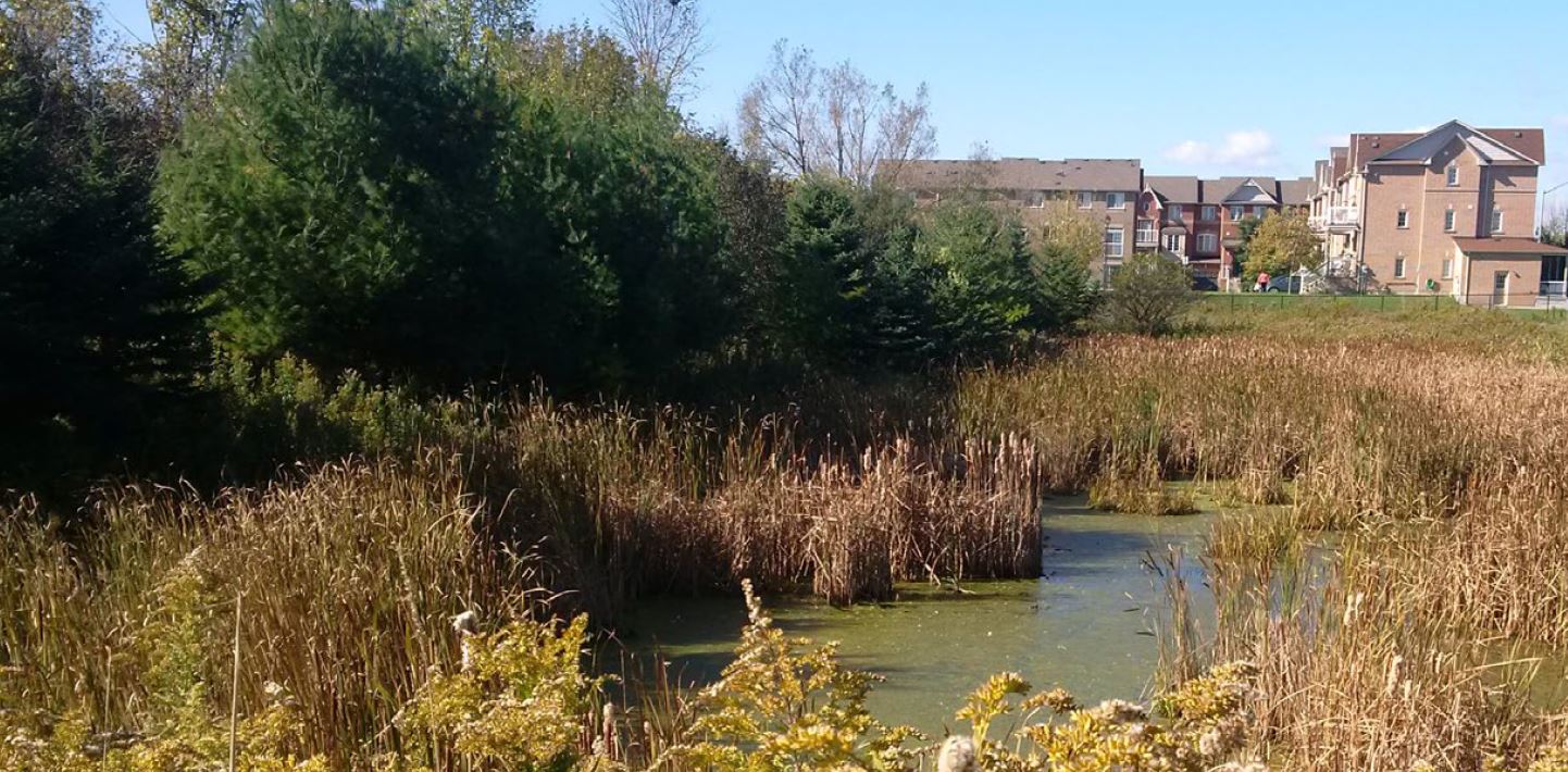
These areas include the Shoal Point Marsh Life Science ANSI, which consists of the coastal Carruthers Creek Wetland Complex, divided into two local Environmentally Significant Areas of Carruthers Marsh and the Carruthers Creek Forest.
The area also falls within TRCA’s target Natural Heritage System (NHS) due to existing natural cover and adjacent lands with the potential for ecological restoration. The TRCA NHS through the cluster captures stream and valley corridors, the wetland complex, forests and connecting and surrounding lands.
The new watershed plan for Carruthers Creek will help to inform future decision-making in the watershed. Development of this plan has been a collaborative effort between TRCA, the Region of Durham, Town of Ajax, and City of Pickering.
Information Sources
Use the following sources to stay informed during a flood:
| • Check your local weather online, or on radio or television before you leave the house. |
| • Check Environment Canada’s public weather alerts |
| • Sign up to receive TRCA flood messages |
| • Check your local municipal and public transit social media links (below). |
Social Media Alerts and Notices
Additional Resources
| • Emergency Management Ontario |
| • Ontario’s Emergency Management and Civil Protection Act: Disaster Recovery Assistance for Ontarians |
| • Public Safety Canada:
|
| • Flood Smart Canada – Created in partnership with the Insurance Bureau of Canada, this resource is designed to help Canadians better prepare for flooding. |
| • Electrical Safety Authority: Flood Safety Information |
| • Intact Centre on Climate Adaptation: Flood Protection Resources |
| • Institute for Catastrophic Loss Reduction: Protect Your Home from Basement Flooding |
Information About Flood Insurance